Our data collection is carried out using an innovative, purpose-built IOS and Android application for mobile and tablet which maps and stores test data.
Details supplied by the client in our CRM system is converted into GPS locations. An engineer is then allocated a geographic area or range of tests to suit their area of expertise. All routing is completed via the application to ensure locating the asset and travel from one location to the next is done in the most efficient manner.
Upon arrival at the asset, if it has been previously tested by Neoterik, our engineer is able to scan a QR code put in place during the previous test and validate the asset and its location. At the end of a ‘new’ test, a small QR label is attached to the asset to allow ease of data access upon future visits.
Data is captured in a number of different ways depending upon the client’s requirements. This could be from a simple asset inventory or a more detailed test to allow the structure to be analysed during a full desktop evaluation.
Additional assets and tasks can be dynamically communicated to the application which deploys work to the engineer working within the closest radius of the new task autonomously.
This data is communicated real time back to our CRM database where the data is processed and reported.
Upon completion of each test, captured data can be reported in a variety of file formats depending upon the client’s requirements.
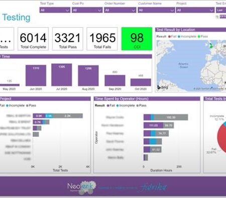
Data groups can be streamed live up to eight times per day to a centralised client portal.
This can be filtered at a high level to graphically display information such as the number of assets visited and tested, and the number which may have failed. This allows for critical safety reactive works to be planned and carried out.


